| Overview | Science | Project | Data | People | Publications | News |
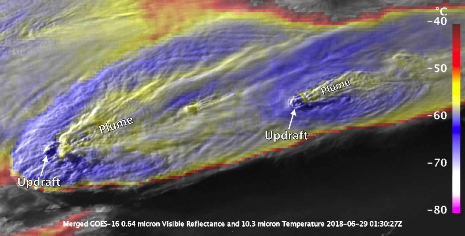
The GOES satellites carry the Advanced Baseline Imager (ABI), which is a passive imaging radiometer that has 16 spectral channels in the visible, near-infrared, and infrared bands at 0.5-2 km resolution (twice the resolution of previous GOES imagers). Routine CONUS images are measured every 5 minutes compared to 15 minutes on previous GOES, with the capability to make detailed high frequency scans (30-60 s) over small domains with strong storm activity.
The MLS takes measurements of microwave emission from Earth's limb to retrieve profiles of atmospheric temperature, humidity, cloud ice, and atmospheric composition in the upper troposphere and stratosphere.
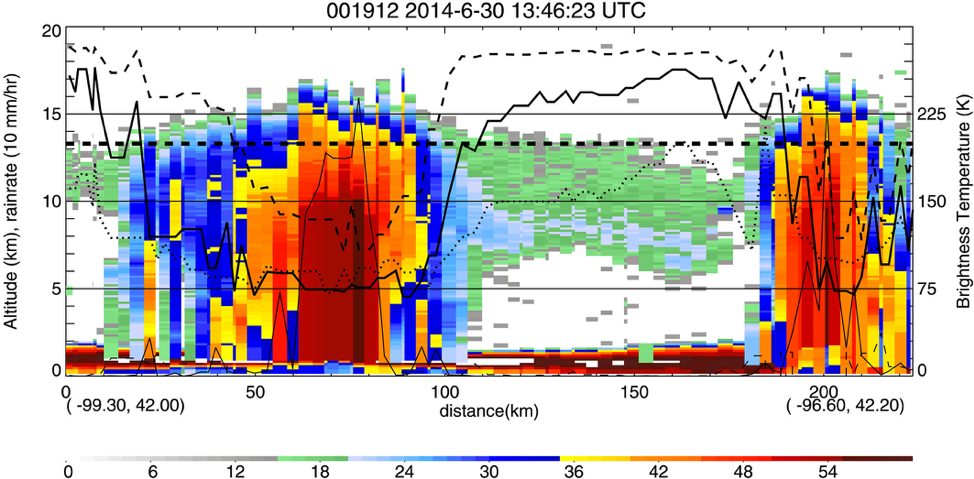
The GPM core satellite observatory carries a 13-channel passive microwave imager (GMI) and a dual-frequency (Ka-/Ku-band) precipitation radar (DPR). The GMI can estimate precipitation from light to heavy rain, as well as light snowfall. The DPR provides 3-dimensional structure of precipitating cloud systems, including precipitation estimates and information about cloud drop size distributions.
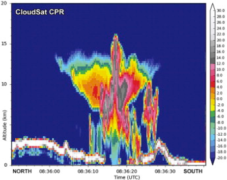
The CloudSat satellite carries the 94 GHz nadir-pointing Cloud Profiling Radar (CPR) that measures the vertical profile of backscattered power from clouds. The short wavelength is very sensitive to small cloud particles and can measure much more of the high clouds and anvil than traditional precipitation radars.
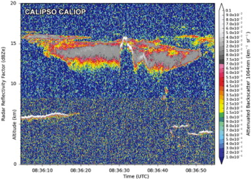
The CALIPSO satellite flies in formation with CloudSat and carries the Cloud-Aerosol Lidar with Orthogonal Polarization (CALIOP), which measures the backscattered signal at 1064 nm and polarized components of the backscattered signal at 532 nm. These measurements provide high resolution vertical profiles of aerosols and clouds and have enhanced sensitivity to detect stratospheric cloud and aerosol layers.