
| Overview | Science | Project | Data | People | Publications | News |
Dynamics and Chemistry of the Summer Stratosphere (DCOTSS) is a NASA Earth Venture Suborbital research project (2019 - 2025) to investigate the impacts of intense thunderstorms over the U.S. on the summertime stratosphere.
The scientific questions being addressed by DCOTSS are discussed on the Science page. Facilities, instruments, and models are described on the Project page.
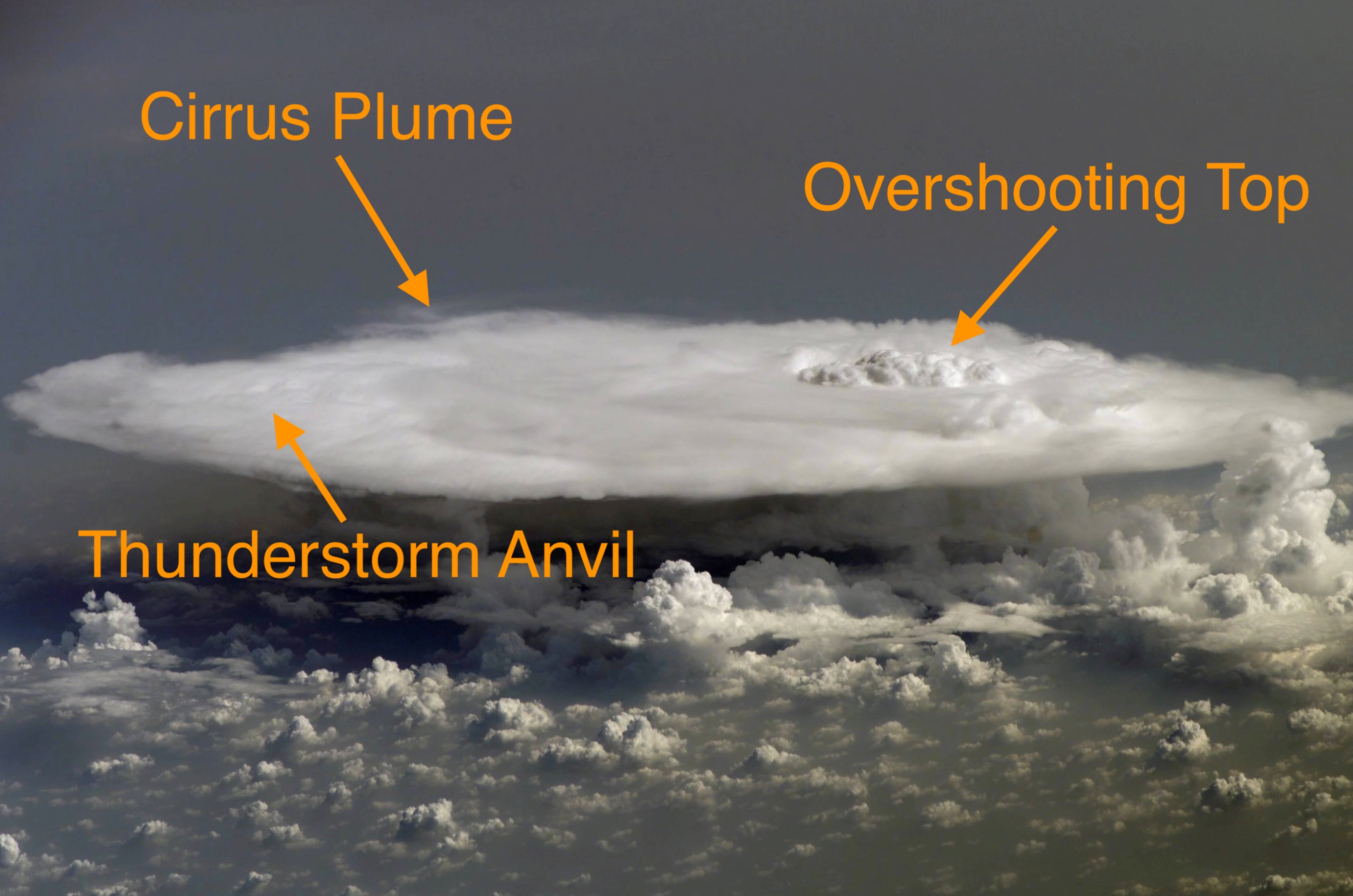
During the summer, strong convective storms over North America overshoot the tropopause into the lower stratosphere. These storms carry water and pollutants from the troposphere into the normally very dry stratosphere, where they can have a significant impact on radiative and chemical processes, potentially including stratospheric ozone. The photo below, taken from the International Space Station, shows one of these storms with an anvil, which is typically near the tropopause level; an overshooting top; and a plume of cirrus (ice) clouds injected into the stratosphere by the overshooting top. Overshooting tops can reach many kilometers above the tropopause into the stratosphere.
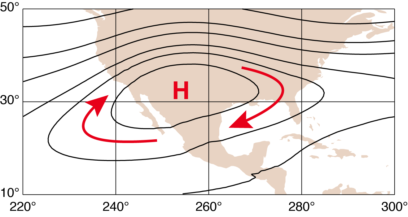
Material transported from the troposphere to the stratosphere by these storms may be trapped by the atmospheric circulation in the lower stratosphere. During the summer, the circulation over North America is dominated by a large high pressure system known as the North American Monsoon Anticyclone (NAMA). As the map below illustrates, air within the NAMA can circulate in a clockwise manner for a considerable period before it escapes.
DCOTSS used the NASA ER-2 high-altitude research aircraft during the summers of 2021 and 2022 to carry out 25 research flights to measure the composition of these convective plumes and determine their effects on the chemistry and composition of the stratosphere. ER-2 flights for DCOTSS were based in Salina, KS, and Palmdale, CA which offer ideal locations for sampling convective plumes in the stratosphere. The ER-2 carried an extensive suite of instruments to measure trace gases and aerosol properties and can operate at altitudes as high as 70,000 feet. Commercial airliners, by comparison, typically fly at around 35,000 feet.

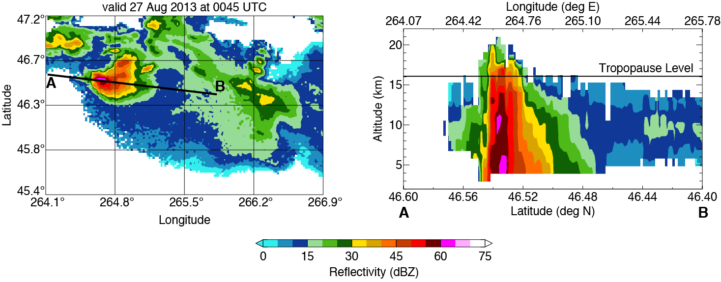
The central U.S. offers an ideal place to investigate overshooting convection. The NEXRAD meteorological radar network, operated by the National Oceanic and Atmospheric Administration (NOAA), provides continuous, high-resolution observations of convective storms. NEXRAD is capable of detecting overshooting convective tops, as shown in this map and cross-section.
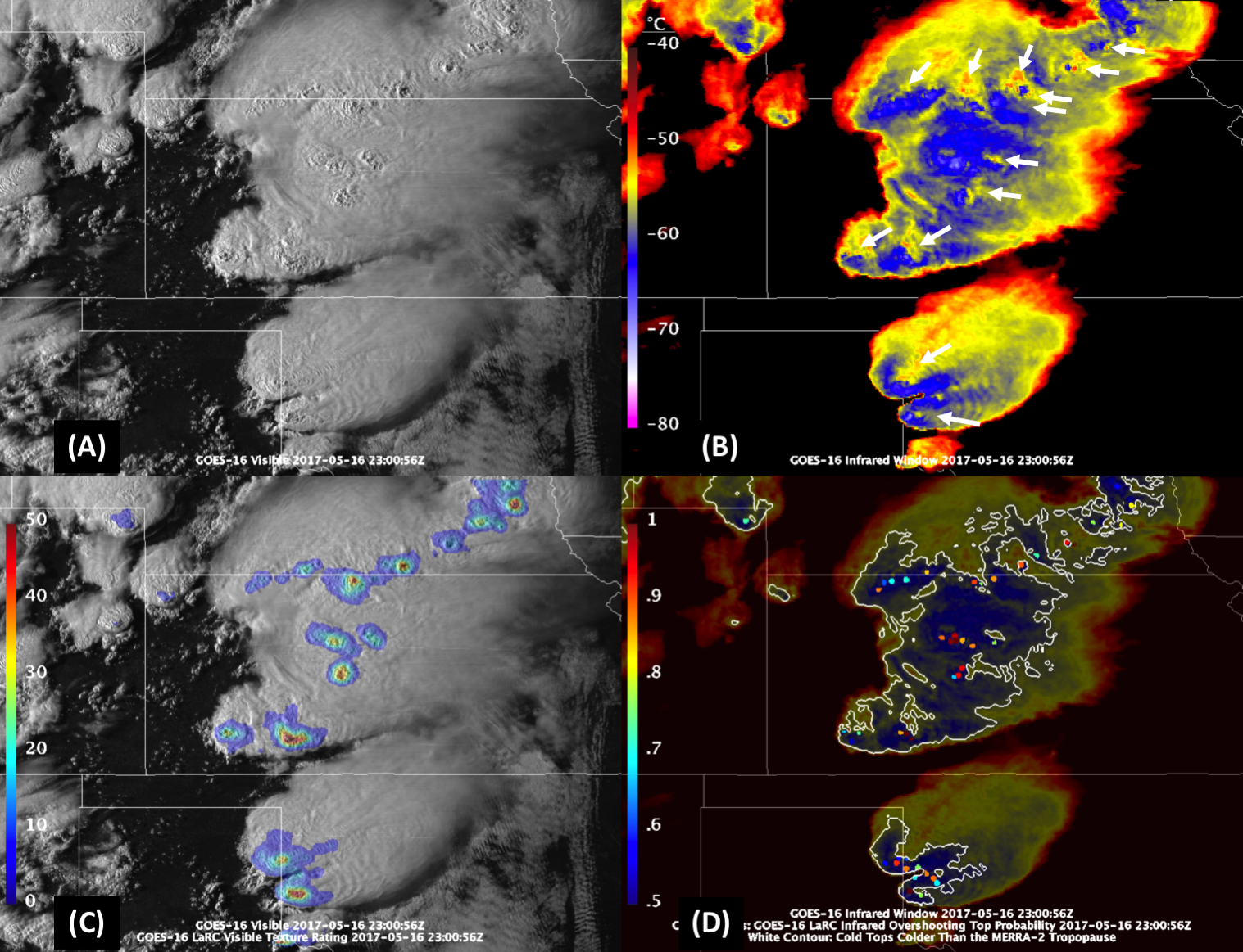
In addition, the NOAA GOES-16 geostationary weather satellite produces frequent high-resolution images of storm locations and cloud-top temperatures. Because atmospheric temperatures in the troposphere decrease with altitude, GOES observations can also be used to identify overshooting storm tops. This figure illustrates how visible cloud top texture and IR temperatures are used to identify overshooting tops.
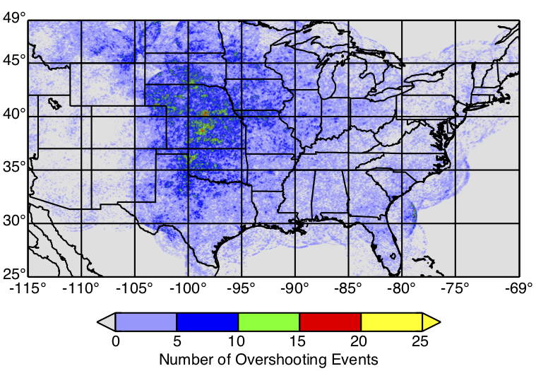
Analysis of NEXRAD data reveals that, on average, there are more than 200 overshooting storms per day over the contiguous U.S. Overshooting storms are most common in the high plains of the central U.S., as can be seen in the figure below, which counts the number of overshooting events within 2 km by 2 km squares over ten summers. Salina, KS is located in the center of the region of highest occurrence of overshooting tops within the U.S.
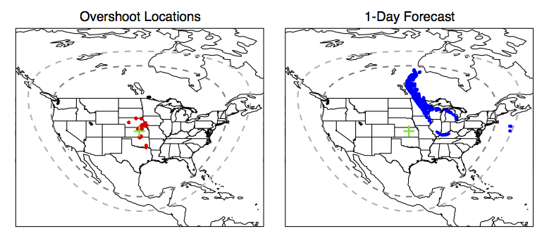
By combining NEXRAD and GOES-16 observations of overshooting tops with forecasts of atmospheric winds from the National Weather Service, the project team was able to predict the location of outflow from overshooting storms. ER-2 flights intercepted outflow plumes from overshooting storms on 22 out of 25 research flights. The remaining research flights were used to observe the large scale structure of the stratosphere.
All data collected during the DCOTSS project is available from the Atmospheric Science Data Center (ASDC) at NASA Langley Research Center.
Participants in the DCOTSS project come from the following universities and government laboratories. For information about the individuals taking part in DCOTSS, see the People tab.